If you’ve driven I-80 during storms like this before, you already know how fast the road can shut down. The National Weather Service has upgraded its earlier watches to full Winter Storm Warnings across the major Sierra corridors. The window runs from Tuesday morning through Wednesday evening, and three NWS offices are coordinating on this one: Sacramento, Reno, and Hanford.
That Didn’t Take Long
Earlier Monday the Sierra was under Winter Storm Watches, with forecasters flagging up to 18 inches of snow and an upgrade likely. That upgrade came through later in the morning. Totals ticked higher after that. Snow in the high terrain now pushes toward 24 inches, and Hanford is calling for crest gusts to 75 mph in the southern Sierra. Sacramento’s product explicitly lists I-80 and Highway 50 in the impact zone.
Donner, Echo, and the Roads Nobody Wants to Drive on Tuesday
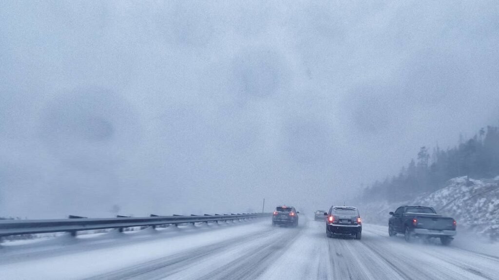
I-80 over Donner Pass sits at roughly 7,000 feet. The Sacramento office names I-80 directly in the warning text, which isn’t always the case. With a foot to a foot and a half forecast at pass level and gusts near 50 mph, chain controls are nearly certain from Tuesday morning onward.
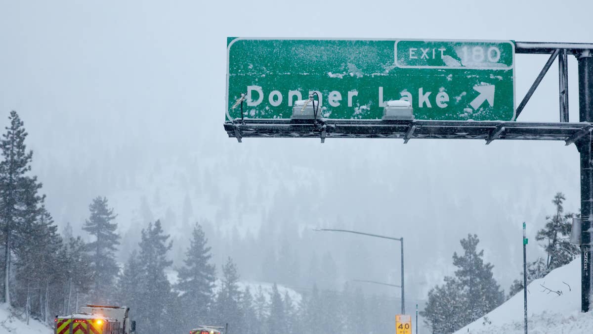
The Sierra storm two weekends ago closed I-80 in both directions after spinouts on Donner Summit. A repeat isn’t guaranteed, but the setup is similar, and it can unravel fast. The warning expires Wednesday evening, but that doesn’t mean the road is clear. Twelve to eighteen inches of snow doesn’t come off a mountain highway in a few hours.
US 50 over Echo Summit (7,382 feet) is the southern route to South Lake Tahoe. Also named in the Sacramento warning. Highway 50 has fewer plowing resources than I-80, and when both routes tighten at the same time, there’s no realistic alternative across the central range.
US 395 runs the east side from Bridgeport through Mammoth Lakes to Bishop. You won’t see the same totals right on the highway, but the Mono County warning extends to highway elevations, and the side roads into Mammoth and June Mountain will be treacherous.
Then there are the smaller routes like CA 88 over Carson Pass, CA 4 through Ebbetts Pass, and CA 168 toward Shaver Lake. These are all exposed, and all have limited plowing. If I-80 and US 50 go to chain controls, don’t count on these as a backup.
Why This One Sticks Around
The bigger issue isn’t just the snow totals. It’s how long the system sticks around. An upper low is pushing inland late Monday into Tuesday, and because it’s moving slowly, it parks over the region long enough to keep snow falling for roughly 36 hours.
Snow levels start around 6,000 to 7,000 feet Monday night and could crash to 4,500 to 5,500 feet by Wednesday. That’s the part that tends to surprise people. Pavement that was bare and warm all weekend is about to get snow at elevations where it hasn’t snowed in weeks, and it lands on surfaces that refreeze overnight into black ice on every bridge and overpass.
The heaviest snow comes Tuesday afternoon and evening, landing right on the Tuesday evening commute, with rates around an inch or two an hour.
If You Still Have to Drive
Caltrans will require chains on most vehicles above 4,000 to 5,000 feet during active controls. AWD doesn’t exempt you from R 3 restrictions. Bring chains even if conditions look clear at departure, and carry the usual kit: blanket, flashlight, phone charger, water, food, shovel, traction sand, full tank of fuel. If you get stranded, stay with the vehicle.
Check Caltrans QuickMap for live road conditions, cameras, and chain controls, or dial 511. Nevada drivers can use NVRoads.com.