Wyoming’s late-season storm is in its final and most damaging phase. The Weather Prediction Center had flagged this storm as a high-probability winter weather event days in advance. As of Monday morning, nine zones remain under Winter Storm Warning from NWS Cheyenne and NWS Riverton until 6 PM MDT tonight, with up to 20 inches of snow still forecast for the Snowy Range and 50 mph wind gusts across the I-80 corridor. NWS Cheyenne describes travel through the Sierra Madre Range as “very difficult to impossible” and warns of “scattered power outages possible due to heavy wet snow on trees and powerlines” along the I-80 corridor between Rawlins and Cheyenne. Live NWS warnings here.
What’s Already Happening
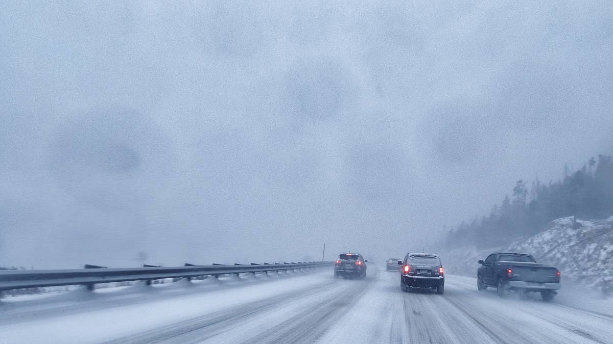
WYDOT has had high-profile vehicle restrictions in place across more than 80 miles of I-80 since early Sunday morning, citing “extreme blow over risk” between Laramie and Cheyenne. Similar restrictions extend to I-25 between Cheyenne and Whitaker Road and US 85 between Cheyenne and Meriden. NWS warnings have been in continuous effect since Sunday evening and are now in their final 12 hours. Snow is falling, winds are at storm strength, and visibility is reduced in places along the I-80 Summit zone.
Where It’s Hitting Today
|
Zone |
Highway / City |
Snow |
Wind |
Through |
|
Snowy Range, North Laramie Range |
Albany, Centennial |
10-20″ |
30-40 mph |
6 PM Mon |
|
Sierra Madre Range |
south of Rawlins |
8-16″ |
50 mph |
6 PM Mon |
|
South Laramie Range |
I-80 Summit Cheyenne-Laramie |
7-14″ |
30-40 mph |
6 PM Mon |
|
Ferris/Seminoe/Shirley Mtns, I-80 corridor |
Elk Mountain, Arlington |
6-12″ |
35-45 mph |
6 PM Mon |
|
Central Carbon County |
Rawlins |
5-10″ |
45 mph |
6 PM Mon |
|
Laramie Valley (Advisory) |
Laramie, I-80 |
2-6″ |
35 mph |
6 PM Mon |
|
Converse County (Advisory) |
Glenrock, Douglas |
2-6″ |
35 mph |
6 PM Mon |
NWS Cheyenne notes that “portions of the Laramie Valley including I-80 may see on the higher end” of the advisory range. Visibility may drop below a quarter mile in Central Carbon County. Tree damage is explicitly forecast in the Sierra Madre Range.
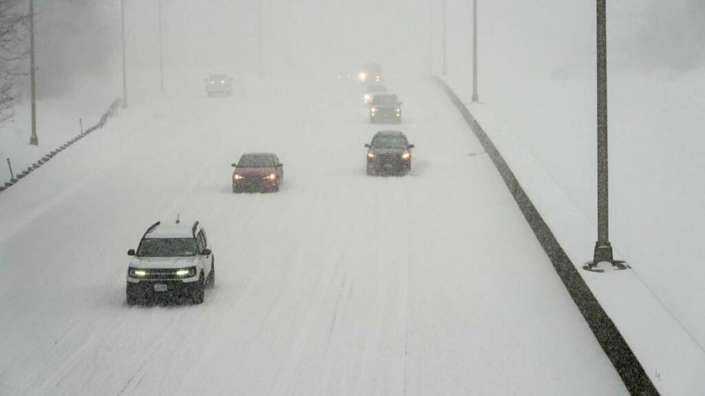
I-80 Is the Story
Interstate 80 crosses every Winter Storm Warning zone in southern Wyoming today, from Wamsutter east through Rawlins, Elk Mountain, Arlington, and the I-80 Summit between Cheyenne and Laramie. WYDOT has issued high-profile vehicle restrictions across multiple segments. With 50 mph crosswinds, heavy wet snow on an open plain, and visibility dropping below a quarter mile in places, full closures are likely before the warning expires this evening. Live status at wyoroad.info.
Getty Images
Roads You Should Think Twice About
Beyond I-80, several Wyoming routes through the warning zones face the same conditions today:
- I-25 between Cheyenne and Casper crosses Converse County and the Laramie Range foothills, both under advisory or warning.
- Highway 130 through the Snowy Range (Centennial to Saratoga) sits inside the highest accumulation zone and may close.
- US 287 between Laramie and Rawlins crosses the South Laramie Range warning area with drifting snow.
- Highway 70 over Battle Pass (Encampment to Baggs) crosses the Sierra Madre Range, where NWS calls travel “very difficult to impossible.”
- US 26 over Togwotee Pass and US 287 over Union Pass remain under warning from NWS Riverton.
What Drivers Need to Know Today
- Do not attempt I-80 between Rock Springs and Cheyenne today in a high-profile vehicle. RVs, box trucks, campers, and anything tall are at extreme blow-over risk in 50 mph crosswinds. WYDOT broadcasts closure information on AM 1610.
- Power outage risk is explicit along I-80. Heavy wet May snow on trees still in full leaf is the worst case for downed power lines. Charge devices and plan for backup heat.
- Refreeze risk Tuesday morning. NWS Cheyenne has issued a Freeze Warning for east central and southeast Wyoming including Wheatland, Glenrock, Douglas, Guernsey, and Torrington, with overnight lows dropping to 21°F. Any pavement wet from Monday’s snow could refreeze into black ice for the Tuesday morning commute.
- Sierra Madre Range travel is “very difficult to impossible” per NWS. Do not attempt unless necessary.
- Tire choice matters more than vehicle choice above 8,000 feet. Three-Peak Mountain Snowflake (3PMSF) tires are the industry standard. Our guide on best practices for driving in snow, ice, and rain covers the trade-offs.
- Cold-soak tire pressure drop is real. A vehicle leaving Cheyenne at 50°F can sit several PSI light at the I-80 Summit at 8,640 feet. Check pressures before climbing.
The warnings expire at 6 PM MDT tonight. Conditions clear across Wyoming by Tuesday morning.
This article will be updated as conditions evolve and as local NWS offices issue formal Winter Storm Warnings.