KANSAS CITY, MO — A multi-hazard storm system arrives tomorrow across the central Plains and lower Missouri Valley, and while severe storms will grab the headlines, the bigger story may be the rain. The Weather Prediction Center is flagging a growing signal for 3 to 5 inches of rainfall concentrating near eastern Kansas, Oklahoma, and southwest Missouri on Saturday, with isolated totals potentially exceeding 5 inches — falling on ground already soaked by multiple rounds of storms this week.
Major Roads That Could Be Impacted
The I-70 corridor from Topeka through Kansas City to Columbia sits squarely in both the severe and flash flood zones, making it the highest-concern route Saturday. I-35 between Wichita, Kansas City, and Des Moines crosses the heart of the severe risk corridor, while I-29 from Kansas City toward Omaha runs along the Missouri Valley instability axis. To the south, I-44 through Joplin and Springfield and I-49 in western Missouri fall inside the heaviest rainfall signal, where flash flooding could develop quickly. In Nebraska, I-80 travelers face the early morning hail window between 3 and 8 a.m. Anyone driving these routes Saturday should build in extra time, watch for ponding, and never drive through flooded roadways.
Timing: An Early Start, Then a Second Act
The first round arrives before sunrise. In Nebraska, the storm window opens around 3 a.m. Saturday, with storms developing over the south-central part of the state and tracking east-northeast through 8 a.m. Because those overnight storms will be elevated, hail is the primary threat in that window rather than tornadoes, with damaging wind a secondary concern.
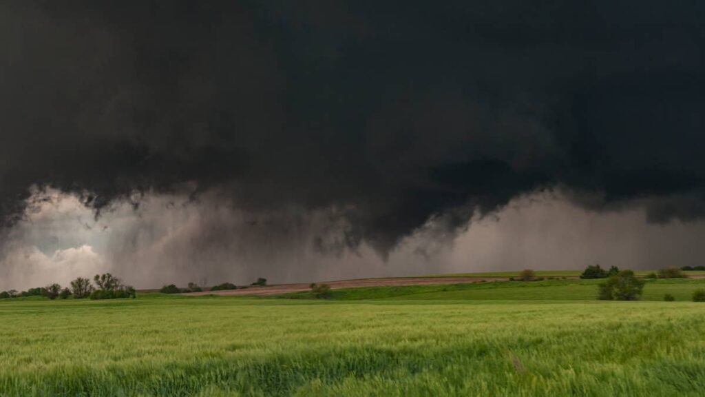
As the system pushes into Kansas and Missouri later in the day, afternoon heating could re-energize the atmosphere ahead of the front, setting up the main severe window for the afternoon and evening hours. If the cold front slows, later development in a more unstable environment could expand the hazard menu.
The Flood Threat Is the Sleeper
The WPC has eastern Kansas and southwest Missouri on the higher end of a Slight Risk for excessive rainfall, with more instances of flooding expected. Multiple rounds of training storms over already-saturated soil is a classic flash flood recipe, and the I-70 corridor through Kansas City sits squarely in the zone. Drivers traveling the corridor Saturday should be prepared for rapidly changing conditions and never drive through flooded roadways.
Bottom Line
If you have weekend plans anywhere from central Kansas through Missouri and into southern Iowa, tomorrow is a day to stay weather-aware. Early morning hail risk gives way to an afternoon and evening severe window, with flash flooding a concern throughout — especially in eastern Kansas and southwest Missouri. Forecast details will sharpen overnight, so check the latest SPC and local National Weather Service updates before heading out Saturday.