Street View is undoubtedly Google Maps’ most remarkable feature
If you spend way too much time on your computer, there is a possibility that you may have spent countless hours exploring the world, both near and far, using Google’s Street View function on its legendary maps application. In my experience, I have found it to be a valuable tool for exploring certain parts of the world without having to drive or hop on an airplane, whether it’s my friend’s house or the ancestral homes of my family.
It’s easy to see why many people find it useful. Google itself states that Street View encompasses over 12 million miles across 110 countries, capturing everything from highways, byways, and freeways to autobahns, as well as the inside of the Grand Canyon. However, its latest project enlisted the help of a special vehicle for a daunting task that most drivers would find challenging.
Off the beaten path
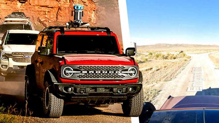
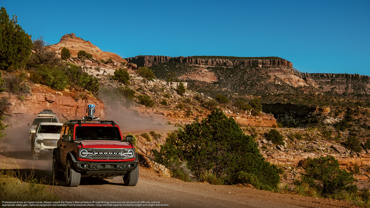
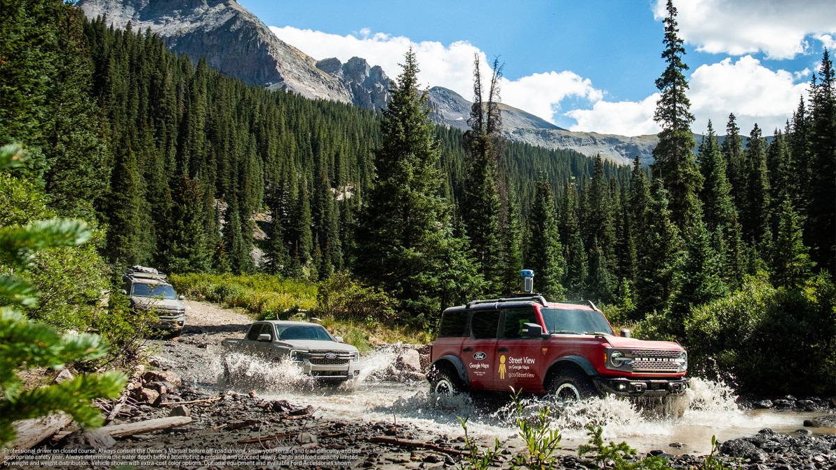
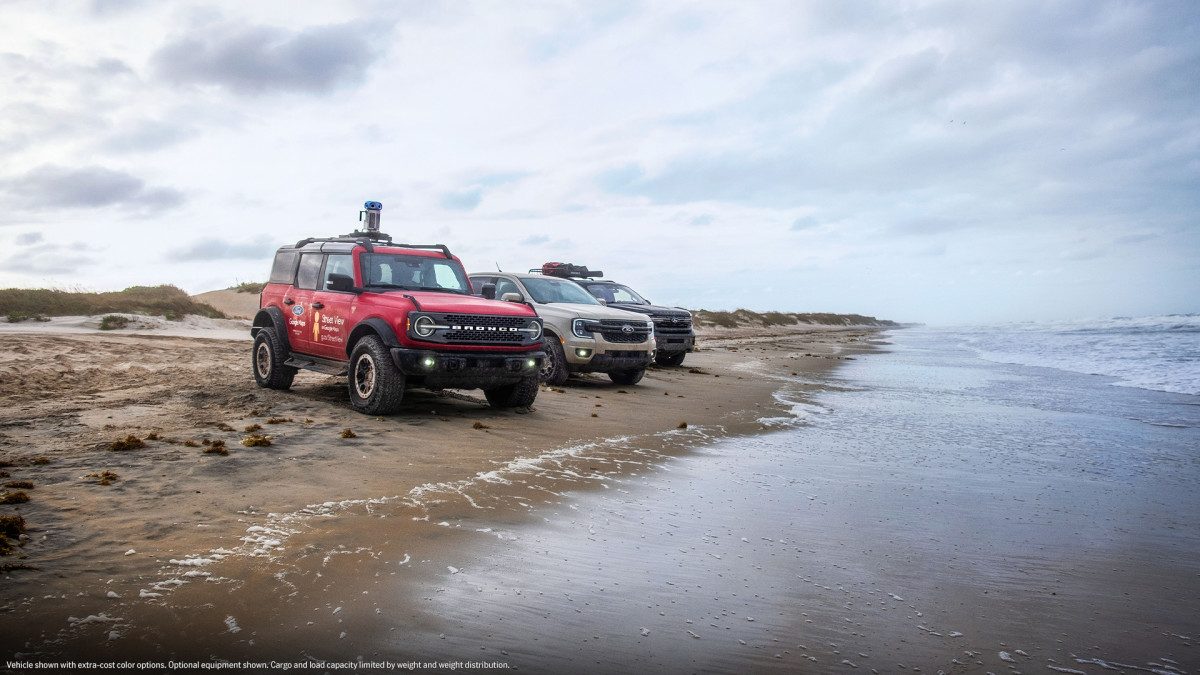
For Google’s latest project, it brought the help of Dearborn-based automaker Ford to attempt to capture the longest off-road trail in the United States: the TransAmerica Trail (TAT), a huge network of mostly unpaved roads spanning more than 5,900 miles from coast to coast through remote, wild, and untouched areas.
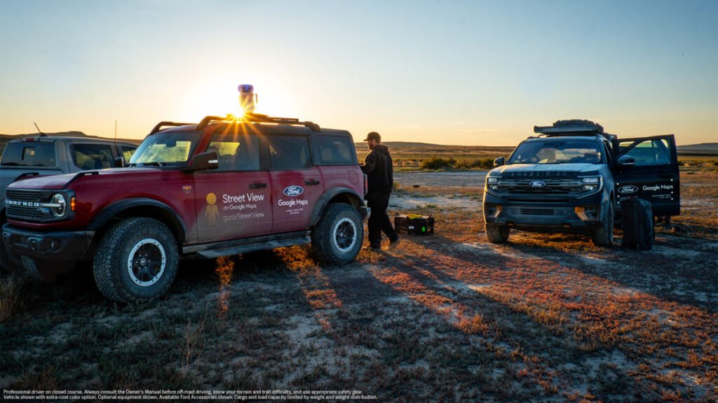
The trail itself is more than just “off the beaten path,” as it has no official signs or singular path throughout the trail. To make this trip feasible, Ford and a small team used three different vehicles: a Ford Ranger, a Ford Expedition Tremor, and a Ford Bronco Badlands. The Bronco led the pack as the lead camera car to capture all of the imagery for Google, while the other two Fords carried additional gear and the rest of the crew.
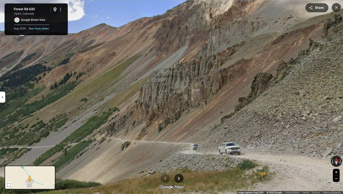
The team began their journey on the coast of Port Orford, Oregon, and ended up in Nags Head, North Carolina, solely on the TAT. In total, it took 32 days to complete, in which they camped, stayed in motels, cooked meals on the side of the road, and ate at small-town restaurants. During that time, Ford and Google encountered all types of terrain, obstacles, and surprises, even capturing some amazing landscapes, including the Great Salt Lake Desert in Utah and the Ophir Pass in Colorado, for Google Street View.
Google has creative ways to capture the world
Apart from the Google Street View cars that roam around various parts of the United States, Google wrote in a 2022 blog post that they have used various other methods to capture Street View, including “the back of a camel in the Arabian desert to a snowmobile zipping through the Arctic.”
However, while Google and Ford used a Bronco (and other Ford-supported vehicles) to capture this trail, Google’s ultra-transportable camera system enables a wide range of vehicles to capture imagery for Street View. According to Google, its newest Street View camera weighs less than 15 pounds, can be attached to any vehicle with a roof rack, and can be operated right from a mobile device, eliminating the need for special equipment or a specialized car.
Final thoughts
It is amazing to see how far technology has come, but the way I see it, using it for this purpose feels doubly good because it defeats the idea our elders had that technology and newfangled gadgetry will keep us socially isolated, inside, and not talking to each other.
By embarking on this journey, Ford was not only able to connect a team of mostly strangers to embark on a journey together, but also help connect people to places they either might not see or light the spark to get them on that journey.