Various online datasets will allow a detailed understanding of Hurricane Melissa as it impacts Jamaica and then Cuba

Hurricane Melissa is now making headlines around the world in anticipation of its landfall today. As always with tropical cyclones, the picture is evolving continuously as the storm evolves. Their behaviour is highly complex.
I thought I’d highlight some useful tools for monitoring the evolution and behaviour of Hurricane Melissa. First, of course, NOAA CPHC provides a range of graphics, some of which are adaptable. This includes the forecast track of the centre of the storm, the forecast earliest arrival time of the centre of the hurricane and (most usefully in the context of landslides), the rainfall potential:
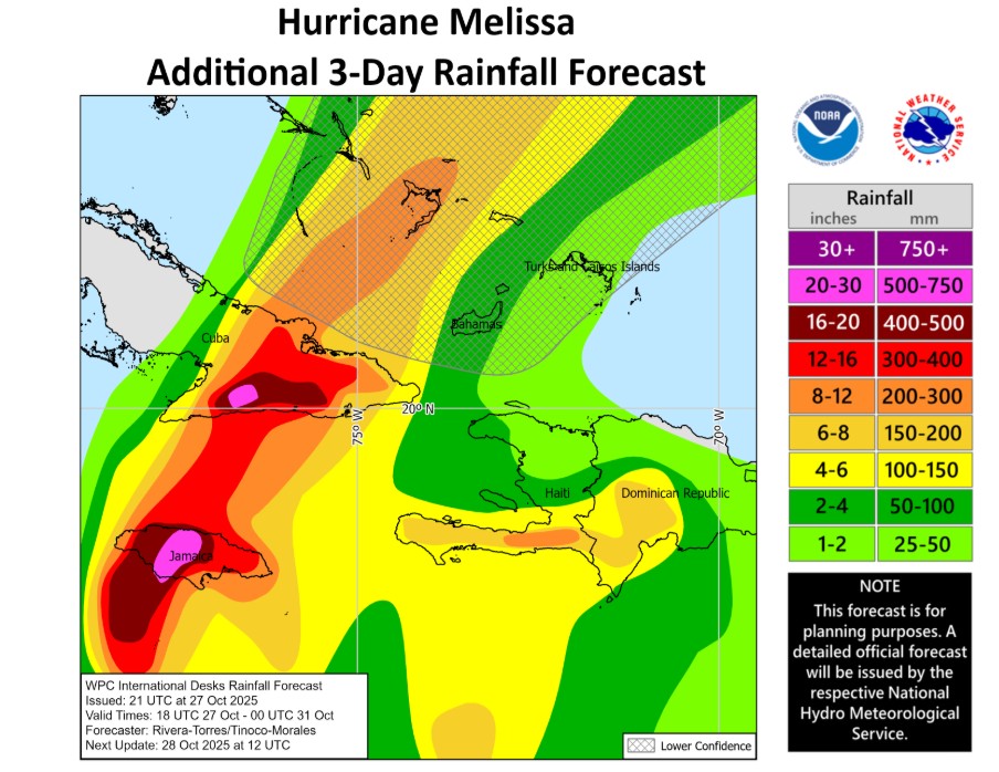
Note that this is three day potential rainfall (the graphic that I posted yesterday was for four days). Jamaica is going to start to feel the full brunt of the storm today (Tuesday 28 October), and it will then move on to eastern Cuba. The latest forecast suggests that the most serious rainfall will occur in the central part of Jamaica, but that there will also be very significant rainfall in the west of the island. The change appears to be the result of a slightly later than forecast turn to the north.
The NASA Global Precipitation Measurement site provides near real time data – the best tool available for understanding the rainfall that the storm is delivering. This is the latest image showing 24 hour precipitation totals:-
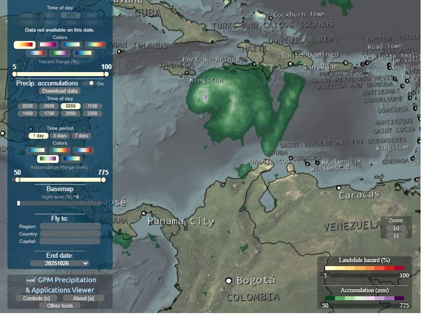
Note that this site also provides a global landslide nowcast, but sadly the site indicates that this is not functioning. I am unsure as to why – maybe this is the effect of the government shutdown.
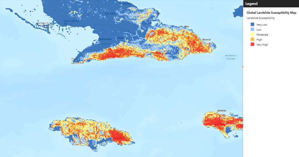
In terms of the landslides themselves, this map of Jamaica and Cuba provides landslide susceptibility – yet again, this is work from NASA:-
Overlaying this with the forecast precipitation is fascinating – the east of Jamaica has the highest landslide susceptibility, but is now forecast to receive less rainfall. Central Jamaica has lower average susceptibility, but may receive more rainfall. But also remember that landslides in storms like this are often driven mostly by rainfall intensity, which is hard to forecast and very variable. There’s also a nice BGS report on landslide hazard for a catchment in Central Jamaica, which gives an idea of the scale of the issues.
In terms of news within Jamaica itself, the Jamaica Observer and the Jamaica Star will be providing local coverage.
Finally, in such situations there is a tendency in the international media to adopt a slightly condescending tone to reporting of such events in countries with lower levels of per capita GDP. Both Jamaica and Cuba have advanced disaster management systems – they are far from helpless victims. Indeed, Cuba has a remarkably successful record of managing disasters and Jamaica fared remarkably well during Hurricane Beryl last year due to its preparedness. But
Text © 2023. The authors. CC BY-NC-ND 3.0
Except where otherwise noted, images are subject to copyright. Any reuse without express permission from the copyright owner is prohibited.