
Energy Secretary Chris Wright is scheduled to be the highest-level Trump administration official to set foot in...
Science

Some federal contractors are feeling the squeeze after the president slashed support for climate programs and other...

Research & Developments is a blog for brief updates that provide context for the flurry of news regarding...
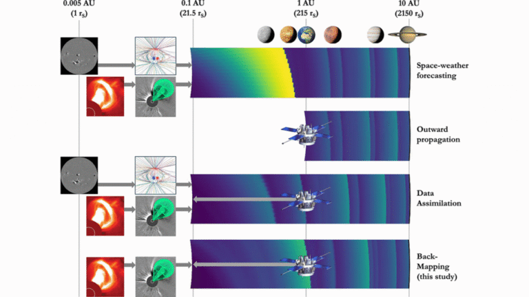
Editors’ Highlights are summaries of recent papers by AGU’s journal editors. Source: Space Weather The solar wind...
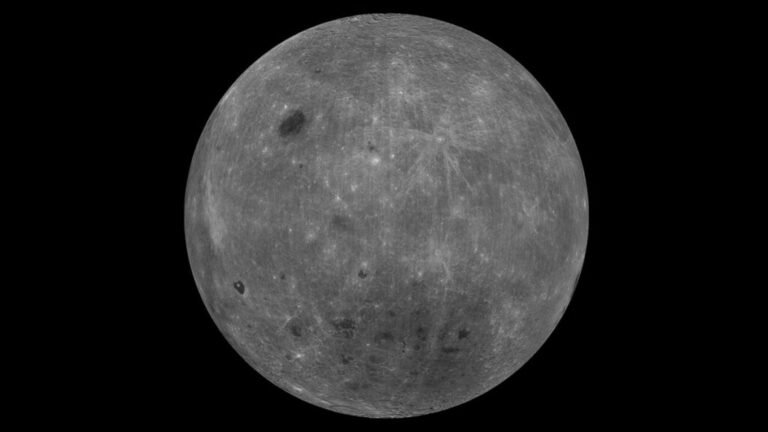
Until 1959, nobody on Earth had ever seen our Moon’s farside. Thanks to gravitational tidal forces, the...
Source: Journal of Geophysical Research: Biogeosciences From 1948 to 1953, a gold mine called Giant Mine released...

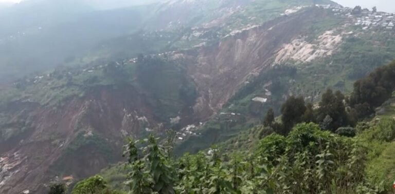
Imagery is now available that shows the aftermath of 3.1 km long landslide that killed about 90...

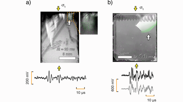
This story was originally published by Knowable Magazine. For close to a century, geoscientists have pondered a...
Earth froze over 717 million years ago. Ice crept down from the poles to the equator, and...
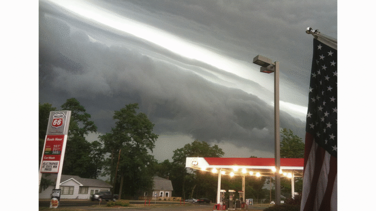
Editors’ Vox is a blog from AGU’s Publications Department. Meteorological tsunamis, or meteotsunamis, are long ocean waves...
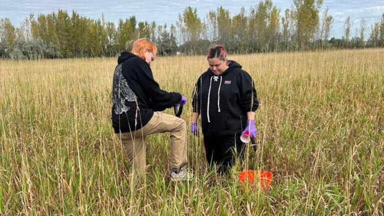
Just 1 gram of soil can host billions of microorganisms and thousands of species of bacteria, fungi,...
Roughly half a century ago, the burgeoning field of marine cartography revealed a curious sight: Mid-ocean ridges...
Editors’ Highlights are summaries of recent papers by AGU’s journal editors. Source: Journal of Geophysical Research: Solid...
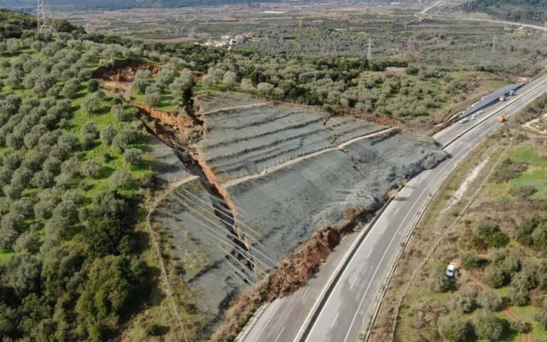
An unusual failure has occurred on a cut slope adjacent to a key road in Greece. On...
There are a few things scientists know for sure about how Earth grows warmer: For instance, when...

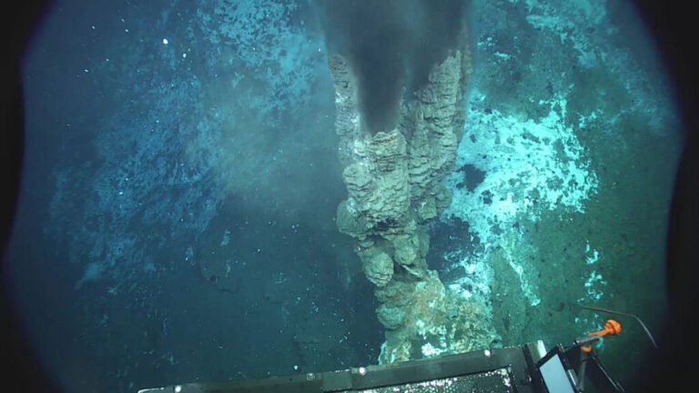
At a natural underwater laboratory off the coast of Papua New Guinea, researchers examined what happens to...
The Landslide Blog is written by Dave Petley, who is widely recognized as a world leader in...
Rainmaker Technology is spending hundreds of thousands of dollars on lobbying and gold-framed Metro ads in a...

The Trump administration’s hands-off approach to the fight over the Colorado River has left states careening towards...

Research & Developments is a blog for brief updates that provide context for the flurry of news regarding...