
Seismic data and eye-witness reports of a displacement wave point to a large landslide at 5:30 am.

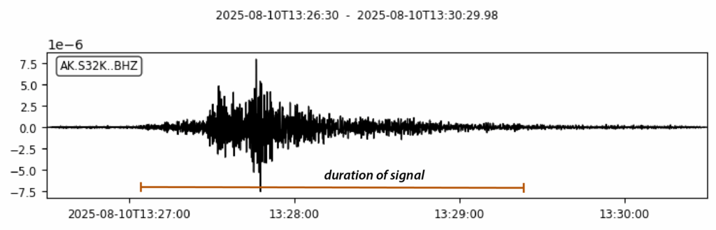
On 10 August 2025, at 5:30 am local time, the Alaska Earthquake Center detected a seismic signal that was almost certainly generated by a landslide. They have posted the record of the seismic signal to Twitter. Their posting included a record of the seismic signal, which looks fairly typical for a landslide:-
There are eye witness reports of the resultant localised displacement wave. BNO News quotes a kayaker who was camping in the affected area.
“Kayaker Sasha Calvey said she and two others were camping on Harbour Island in Tracy Arm Inlet, a fjord about 45 miles south of Juneau, when a landslide or iceberg caused a tidal surge that swept away half of their gear, including one boat, personal items, and cooking equipment.
“Calvey said their gear had been stored about 25 feet above the high tide line, but the water reached it and came within an inch of sweeping away their tent. She added that they placed a radio distress call that was picked up by a boat, which transported them to Juneau.”
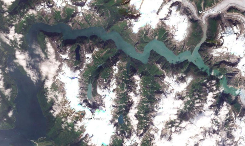
The mouth of Tracy Arm is at [57.7778, -133.6167]. This is the latest Planet Labs image of the area, captured on 7 August 2025 (last Thursday):-
This is steep and rugged terrain, but the image provides no obvious hint of the location of the landslide that occurred three days later, as far as I can see. Hopefully, someone will capture a satellite image in the next few days that will shed light on the location, but that will depend upon the weather. Alternatively, the location might be identified from a boat or from an aerial survey.
I will undoubtedly return to this theme in the coming days.
Reference
Planet Team 2024. Planet Application Program Interface: In Space for Life on Earth. San Francisco, CA. https://www.planet.com/
Text © 2023. The authors. CC BY-NC-ND 3.0
Except where otherwise noted, images are subject to copyright. Any reuse without express permission from the copyright owner is prohibited.