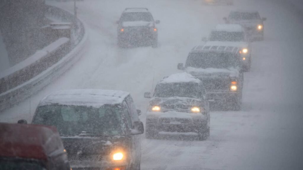
Winter storm warnings now cover a long list of highway passes, with up to 20 inches of snow and gusts as high as 45 mph expected between Saturday afternoon and Monday. A wind advisory runs alongside them overnight Saturday, with isolated gusts near 50 mph. For most of the warned areas, Sunday falls entirely within the alert window, and snow on pavement is expected mainly from evening through late morning.
Roads And Passes Under Alerts
The National Weather Service offices in Great Falls, Missoula and Billings issued the winter storm warnings on Friday, most of them upgrades from earlier winter storm watches, all in Montana. Winter weather advisories cover much of the rest of the region. The table lists the largest totals on roads and passes NWS names in those alerts.
|
Road or pass |
Alert |
Snow |
Gusts |
Window (ET) |
|
Rogers Pass, Flesher Pass, MacDonald Pass |
Winter storm warning |
10 to 20 in. |
45 mph |
2 p.m. Sat to 8 a.m. Mon |
|
Kings Hill Pass, Elk Park Pass, Homestake Pass |
Winter storm warning |
6 to 12 in. |
45 mph |
8 p.m. Sat to 8 a.m. Mon |
|
Bozeman Pass, Battle Ridge Pass, Deep Creek Pass |
Winter storm warning |
6 to 12 in. |
40 mph |
8 p.m. Sat to 8 a.m. Mon |
|
I-90, Big Timber to Livingston and over Bozeman Pass |
Winter weather advisory |
2 to 6 in., more than 6 in. on the pass |
40 mph |
2 a.m. Sun to 2 p.m. Mon |
|
US-191 through Melville |
Winter storm warning |
5 to 10 in. |
40 mph |
2 a.m. Sun to 2 p.m. Mon |
|
Targhee Pass, Raynolds Pass |
Winter weather advisory |
4 to 8 in., up to 12 in. above 8,000 ft |
45 mph |
8 p.m. Sat to 8 a.m. Mon |
|
Highway 12, Garrison to Elliston |
Winter storm warning |
3 to 9 in. |
45 mph |
8 p.m. Sat to 8 a.m. Mon |
Advisories cover the rest of the routes NWS names, with 1 to 6 inches on most of them and up to 10 inches on the higher passes. That includes I-90 from East Missoula to Bearmouth, where NWS Missoula now expects travel to be very difficult through Monday morning, while the Billings office calls I-90 over Bozeman Pass “particularly hazardous.”
Cooke City could get 10 to 18 inches, with the most above 8,000 feet, and Great Falls 5 to 10 inches. Nearly every warning carries the same impact line: travel could be very difficult.
Timing And Road Surfaces
NWS Great Falls expects snow amounts to “vary drastically from grassy surfaces to roadways,” especially at lower elevations, with accumulation on pavement confined mainly to the evening through late morning hours. Midday totals on the road may look light compared with what builds up overnight.
The snow is also expected to be wet and heavy. Combined with gusty wind, forecasters say it could bring down tree branches and cause isolated power outages.
Wind Advisory
The wind advisory covers the Flathead and Mission valleys from 8 p.m. ET Saturday to 8 a.m. ET Sunday, with northeast winds of 15 to 25 mph and gusts up to 40 mph. Isolated gusts near 50 mph are possible in west to east gaps along Highway 35, including Lake Blaine. NWS warns that winds this strong can make driving difficult, especially for high profile vehicles.
Driving Tips
With snow expected to stick to pavement mainly from evening through late morning, a pass crossing in early or mid afternoon gives the best odds of a clear road, and checking 511 before leaving shows whether plows have caught up. Wet, heavy snow packs down quickly under traffic, so slower speeds and a longer following distance matter more than usual on downhill grades, and fallen branches are possible on rural roads with these winds. A full fuel tank helps if a closure turns a short trip into a long wait. NWS also advises keeping an extra flashlight, food and water in the vehicle in case of an emergency.