NOAA’s Climate Prediction Center now puts the odds at 69% for an October to December RONI of at least +2.5°C, a level that would exceed every El Niño in its record since 1950. Events that size pull the winter storm track south, into the Sierra and the southern Rockies.
A new OpenSnow winter forecast favors California, Utah, Arizona, New Mexico and southern Colorado, and leans thin across Washington, northern Montana and the Upper Midwest. Donner Summit, Parleys Summit and Wolf Creek Pass all sit inside the favored zone, and Colorado and Utah enforce some of the strictest traction requirements in the country on the roads that reach them.
What The Climate Prediction Center Said
The CPC’s ENSO Diagnostic Discussion issued 13 August carries an El Niño Advisory and a greater than 90% chance of a very strong event through fall and winter 2026-27, with sea surface temperature anomalies already exceeding +2.0°C in the eastern equatorial Pacific.
The number driving the coverage is the October to December projection: a 69% chance of a three-month RONI value of +2.5°C or higher, which would exceed anything in the record since 1950. CPC publishes the probabilistic RONI forecast and its percentile ranges separately, and it is the index the agency now uses for official ENSO monitoring in place of the older ONI. The caveat it attaches every month applies here as well, that an event this size raises the odds of typical El Niño impacts without guaranteeing them in any one place.
Where The Snow Goes
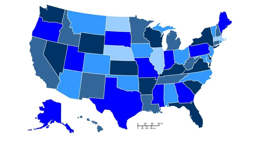
The OpenSnow forecast is built on analog years including 1982-83, 1997-98, 2015-16 and 2023-24, and the five states it favors are California, Utah, Arizona, New Mexico and the southern and eastern mountains of Colorado. You can view the map here.
Within California the strongest signal sits in the Central Sierra around Mammoth and China Peak, with Tahoe also favored and the Southern California areas of Mountain High and Snow Summit historically gaining the most in strong El Niño years. In Utah, Park City correlates most strongly with above-normal snow during the most extreme events, and Alta, Snowbird, Brighton, Solitude, Snowbasin and Brian Head lean the same way. Arizona’s high country covers Snowbowl and Sunrise Park, and the New Mexico signal runs through Taos.
Colorado splits along the Continental Divide. The San Juans and the ranges near and east of it are favored, which covers Wolf Creek, Purgatory, Silverton, Telluride, Winter Park, Loveland and Eldora, while Vail, Copper, Breckenridge, Keystone, Aspen, Crested Butte and Steamboat sit in the equal-chances zone. The Front Range foothills and cities also tend to run above average in these patterns. Storms tracking in from the south bring easterly surface winds that push precipitation against the eastern side of the Divide, and that matters for the Denver metro commute as much as it does for ski traffic.
Below-normal snowfall is favored across the northern tier and much of Canada. Washington lands there on temperature rather than precipitation, with equal chances of above or below normal moisture and a warm signal that turns some of it to rain.
Temperature Is The Part That Matters For Traction
Above-average temperatures are favored across roughly the northern two thirds of the country. Strong El Niño winters run an energetic subtropical jet, which means storms arrive warm and wet, and OpenSnow flags the consequence for both California and Utah: high snow levels and rain reaching elevations that would normally see snow. Rain falling onto packed snow, wet slush at pass level and an overnight refreeze all leave roads that look merely wet in daylight.
The elevation gradient can also be short. Salt Lake City is favored for below-average snowfall this winter while the canyons rising directly above it are favored for above-average, which is a 20-minute drive and a complete change of surface.
Chain Controls And Traction Laws Have Tightened
Colorado’s Passenger Vehicle Traction Law runs automatically from September 1 through May 31 on the 126-mile I-70 stretch between Dotsero and Morrison, and CDOT can switch it on across any state highway, which is how it reaches Wolf Creek and Red Mountain Pass. The standard is 3/16-inch tread on winter, all-weather or M+S rated tires, or chains on two or more drive wheels, and four-wheel drive does not exempt a vehicle from the tread requirement, which catches out crossover owners running worn all-seasons. Noncompliance costs $50 plus a $17 surcharge.
Colorado’s biggest snowfall signal comes in October through December and again in March and April. Those are the shoulder months when winter tires are either not yet fitted or already swapped off, and both sit inside the traction law window.
Utah went further last year. Under HB 196, UDOT can now enforce traction requirements up to 24 hours before a storm arrives, and a new Class Three designation raises the minimum to 5/32-inch tread in the Cottonwood Canyons. In California, R2 is the common setting on I-80 over Donner, and it lets AWD and 4WD through on snow-tread tires at all four corners provided chains are carried.
Corridors In The Favored Zone
|
Region |
What The Outlook Favors |
Corridors |
|
Central Sierra Nevada, CA |
Strongest signal in the state, around Mammoth and China Peak |
I-80 over Donner Summit, US-50 over Echo Summit |
|
Wasatch, UT |
Above-average season, strongest correlation at Park City |
I-80 over Parleys Summit, SR-210 through Little Cottonwood Canyon |
|
Northern Arizona |
Above-average snowfall in the high country |
I-40 and US-180 near Flagstaff, US-89A through Oak Creek Canyon |
|
New Mexico |
Above-average, weighted to November-December and March-April |
US-64 over Palo Flechado Pass, NM-150 to Taos Ski Valley |
|
Southern and eastern Colorado |
San Juans and the ranges near and east of the Divide |
US-160 over Wolf Creek Pass, US-550 over Red Mountain Pass |
Sonora and Tioga Passes sit inside the favored zone but close for the season regardless of how much falls, so the winter driving question in California stays with I-80 and US-50, the two routes held open across the Sierra crest.
The East Gets Fewer Storms, Not Easier Ones
Below-normal snowfall is favored across New England, New York State and the Upper Midwest, driven by warmth rather than dry air. New York City sits at a neutral signal while the rest of the state leans below normal, because strong El Niño winters push more coastal storms up the Atlantic seaboard. Washington, Baltimore and Philadelphia behave the same way in the analog years, with some seasons producing almost nothing and others reaching an above-average total on the strength of one storm across the I-95 corridor.
The Southern Appalachians carry an above-normal signal in January and February when cold air lines up with that track, which puts I-40 through the North Carolina mountains and I-77 over Fancy Gap on the same footing as the western passes.
What Is Not Settled
The 2015-16 super El Niño underdelivered across California and New Mexico, a reminder that the correlation is a tilt rather than a rule. The Pacific Decadal Oscillation is currently out of phase with the developing event, and confidence in its influence this season is low. Individual members of the August European seasonal model project Niño-3.4 anomalies peaking between 3.5°C and 4.5°C by late fall. CPC updates the picture on 10 September.