The late-season Pacific trough that closed more than 200 miles of I-80 across southern Wyoming on Monday is now reloading over the Colorado Rockies, with the Weather Prediction Center describing heavy wet snow across the Central Rockies before the main band tapers off tonight and a secondary round of moisture continuing through Thursday morning.
The I-70 corridor and the West Slope are at risk, with Continental Divide totals running 12 to 18 inches in the expected scenario and 18 to 24 inches across the highest peaks. The high-end NWS forecast pushes Longs Peak and Mount Blue Sky toward 24 to 30 inches, and Mountain-Forecast modeling stretches Longs Peak to nearly 49 inches through Thursday night.
Peak Driving Danger Window
Tuesday afternoon through Wednesday morning. The Eisenhower Tunnel approach, Vail Pass, and Berthoud Pass face combined heavy snow, drifting, and overnight lows in the teens above 10,000 feet.
What to Expect
If this storm pans out as expected, snow rates are heaviest along and just north of I-70, with the Park Range above Steamboat Springs and the higher terrain of Rocky Mountain National Park seeing the deepest totals.
- Continental Divide expected snowfall: 12 to 18 inches through Thursday morning, locally 18 to 24 inches across Mount Blue Sky and the Park Range
- High-end (10 percent): 24 to 30 inches on the highest peaks, with private models suggesting 43 to 49 inches on Longs Peak through Thursday night
- Wet, clingy snow loading on already-leafed trees raises power outage risk near I-70 ski towns
- Behind the storm, NWS Grand Junction has a Freeze Warning re-issued for the Yampa River Basin (Craig, Hayden, Meeker, Rangely) for Wednesday morning with lows near 22 degrees, and NWS Boulder has a Frost Advisory active for the Northeast Colorado plains from Fort Collins through Greeley, Loveland, Sterling, Akron, and Fort Morgan
Road Conditions
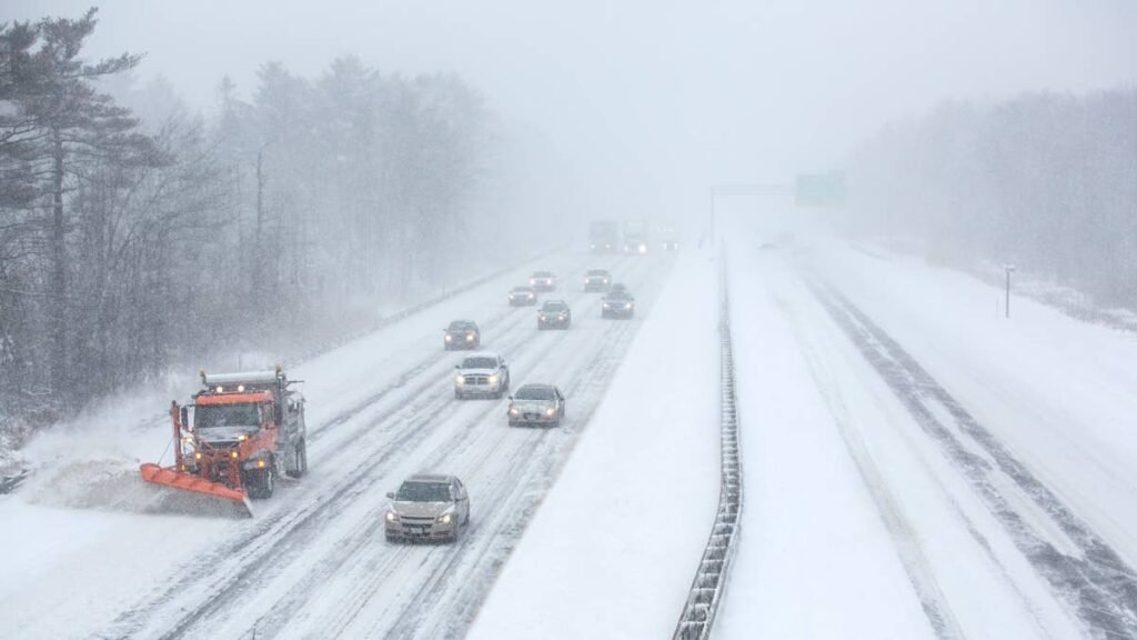
I-70 over the Continental Divide is the central corridor at risk. Chain controls and intermittent multi-hour closures are likely Tuesday into Wednesday, with the Eisenhower Tunnel at 11,158 feet acting as the usual choke point. Berthoud Pass on US-40 runs higher and reaches winter conditions first. Vail Pass and Loveland Pass sit inside the highest accumulation zone.
Other named corridors crossing the warning area include US-40 over Rabbit Ears Pass between Kremmling and Steamboat, US-285 over Kenosha Pass and Hoosier Pass, and US-34 across Trail Ridge Road inside Rocky Mountain National Park. WYDOT’s staged reopening of I-80 across southern Wyoming is targeted between 6 and 8 AM MDT Tuesday, but high-profile vehicle restrictions are likely to continue into the day across the I-80 Summit between Cheyenne and Laramie. For live Colorado road status and chain control activation, use COtrip.org.
Trail Ridge Road and the Memorial Day Window
The National Park Service has been actively plowing Trail Ridge Road since late April, and the May 5 through 7 system already reloaded the snowpack across the 11-mile stretch above 11,500 feet. This second event puts the road’s Memorial Day weekend (May 23 through 25) opening at clear risk. Last year Trail Ridge opened on May 30, the earliest opening on record was May 7, 2002, and the latest was June 26, 1943.
Winter Driving Tips
The snow stacking up across I-70 is the heavy, wet, late-spring variety that packs into tread blocks. Tire setup and approach speed matter more than drivetrain. Autoblog’s roundup of the best cars and SUVs for snow and winter driving ranks options by AWD system, ground clearance, and snow-mode tuning, and our winter driving fundamentals guide covers technique.
- Three-Peak Mountain Snowflake (3PMSF) tires with at least 4/32 inch tread are the floor for any Continental Divide pass during the warning window
- Carry chains regardless of drivetrain. Colorado’s Passenger Vehicle Chain Law applies to AWD and 4WD once activated
- Drop tire pressure 1 to 2 PSI for every 10-degree temperature drop between Denver and the tunnel approach
- Triple your following distance on snowpack and slush, and never use cruise control in winter conditions
- Behind the storm, watch for black ice on bridges and overpasses Wednesday morning, including in the foothills and along the Front Range where overnight lows fall back near freezing
Timing
This storm runs Wednesday afternoon across most of the Colorado high country, with NWS Grand Junction’s West Slope warnings extending into Wednesday evening across the San Juans and the Park Range. Light wraparound moisture lingers into Thursday morning across the Northern Front Range and Rocky Mountain National Park.