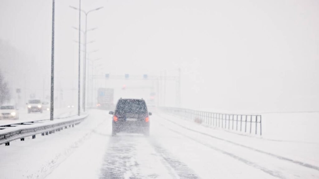
A powerful Pacific storm is set to slam Southwest Alaska this weekend with hurricane-force wind gusts, heavy snow, and freezing rain through Sunday morning, according to NWS Anchorage. The agency issued overlapping High Wind Warnings and Winter Weather Advisories today, Friday May 8, 2026, with officials explicitly warning of slick roads and difficult travel.
Peak Driving Danger Window
The most dangerous window runs late Saturday night through Sunday morning, when 90 mph gusts in the Alaska Peninsula channels overlap with active snow and freezing rain on local roads, creating compound traction and stability risks for anyone out driving.
What to Expect
- Wind gusts: 90 mph in the Alaska Peninsula channels, 80 mph in the Eastern Aleutians and Pribilof Islands, 75 mph along the Kuskokwim Delta Coast
- Snow totals: 9 to 13 inches in the Lower Kuskokwim Valley; 8 to 12 inches across Bristol Bay north of King Salmon
- Mixed precipitation: Freezing rain and snow along the Kuskokwim Delta Coast
NWS Anchorage flagged the wind forecast with “high confidence,” while the snow and freezing rain advisories carry slightly less certainty but cover the same active window.
Road Conditions
Bethel’s roughly 22 miles of paved roads, the King Salmon to Naknek spur, and Unalaska’s local grid all face gusts the NWS classifies as hurricane-force at 75 mph and above, with the agency noting that “moving automobiles can be pushed off the roadways” at those speeds. Drivers should monitor Alaska 511 for state-maintained route updates and treat exposed coastal segments as live wind-tunnel zones until the system clears.
Severe Storm Driving Tips
Hurricane-force gusts demand a different posture than routine winter driving. Slow well below the posted limit, keep both hands at the 9 and 3 wheel positions, and anticipate lateral pushes from crosswinds when transitioning from sheltered terrain to open coastline. Triple your normal following distance, and give high-profile vehicles like semis a wide berth since they catch wind like sails.
For the snow and ice piece, tire and vehicle setup matter. Autoblog’s roundup of the best cars and SUVs for snow and winter driving and our guide to best practices in snow, ice, and rain cover the fundamentals. Three-Peak Mountain Snowflake (3PMSF) tires are the minimum for ice-adjacent conditions, with tread depth at 4/32 inch or deeper. Add 1 to 2 PSI for every 10 degree temperature drop, triple your stopping distance on packed snow, and never use cruise control on ice. Pack a winter emergency kit per NWS winter weather safety guidance, including traction aids, water, layered clothing, and a charged power bank.
Timing
The High Wind Warnings and Winter Weather Advisories run through Sunday morning, with peak impacts late Saturday into early Sunday. Conditions ease Sunday afternoon as the system tracks east, though residual gusts and refreezing surfaces could linger into Monday across coastal zones. Forecasters are already eyeing the next Pacific frontal system stacking up behind this one. We’ll update this article as conditions evolve.