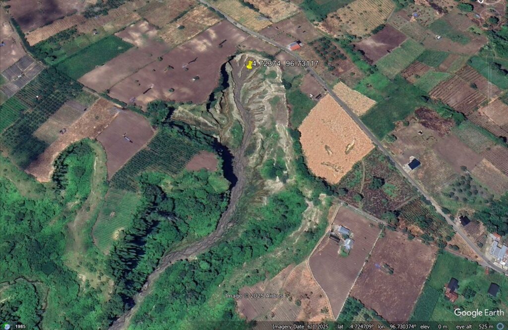

A massive gully has been developing over the last two decades at Pondok Balik. It now covers an area of over 3 hectares.

In Indonesia, a massive and rapidly developing gully is causing considerable concern. Located at Pondok Balik in Central Aceh Regency, Aceh province, this feature has been developing since 2004. Reuters has an excellent gallery of images that is worth a view. There is a really good summary of the history of this gully on The Watchers website too.
There is some nice drone footage of this feature in this SindoNews report on Youtube:-
The location of this very large gully is [4.72374, 96.73117]. This is a Google Earth image of it, captured in June 2025:-
By comparison, here is an image from February 2015:-
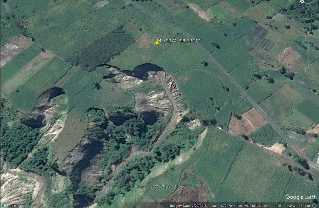
And here is a slider to compare the two, showing the raid development of the gully:-


The gully is reportedly developing in loose volcanic materials, which are prone to rapid erosion when disturbed and saturated. In Indonesia, rainfall totals are high.
There are concerns about potential damage to the road seen in the image and to high voltage electricity pylons running through the area. It is proposed to seek to manage the hazard by reinforcing the soil and managing surface and subsurface water. This will not be straightforward or cheap.
Text © 2026. The authors. CC BY-NC-ND 3.0
Except where otherwise noted, images are subject to copyright. Any reuse without express permission from the copyright owner is prohibited.