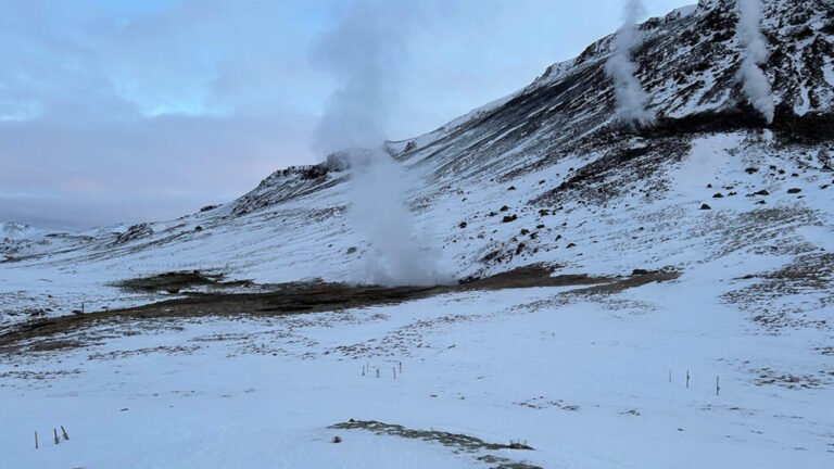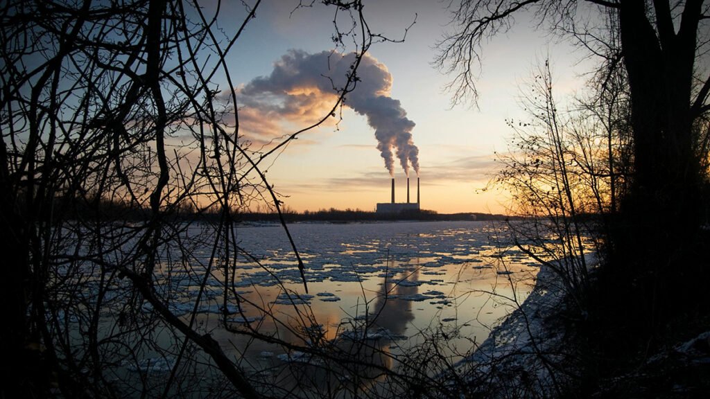

In recent years, the international community has made progress in slowing increases in the rate of carbon dioxide emissions and in acknowledging the scale of methane leaks from oil and gas facilities. However, carbon dioxide emissions continue to rise, methane releases from the energy sector have not abated, and there is more need than ever for targeted and sustained greenhouse gas (GHG) emissions reductions and other climate change mitigation approaches.
The success of climate change mitigation approaches relies in part on having accurate, timely, and integrated carbon cycle data from surface, airborne, and satellite sensors.
The success of such actions relies in part on having accurate, timely, and integrated carbon cycle data from surface, airborne, and satellite sensors covering local, regional, and international scales. These data improve efforts to track emissions reductions, identify and mitigate unexpected emissions and leaks, and monitor ecosystem feedbacks to inform land management.
In September 2024, researchers in the carbon cycle monitoring community met to discuss how best to establish a more effective system for monitoring GHGs and to help accelerate climate action through better data and decision support.
Here we highlight issues and challenges facing emissions monitoring and documentation efforts illuminated during the September meeting, as well as ideas and proposals for tackling the challenges. The recommendations emphasize the urgency of enhanced monitoring to support the goals of the Paris Agreement and the Global Methane Pledge, particularly in the face of increasing climate extremes and the vulnerability of Earth’s natural carbon reservoirs [Friedlingstein et al., 2025].
Bottom-Up Meets Top-Down
Parties to the Paris Agreement track their progress toward meeting GHG emissions reduction targets through bottom-up accounting methods that track carbon using local ground-based observations. These methods combine information about the spatial extents of carbon sources and sinks with estimates of how much these sources and sinks emit or take up, respectively.
This inventorying approach offers high-precision information at time intervals that support long-term tracking. However, it is also often time intensive, depends on country-specific methodologies, may not accurately reflect spatiotemporal variability in GHG fluxes, and is not suited for operational monitoring of sudden changes or reversals [Elguindi et al., 2020; Nicholls et al., 2015].
Top-down approaches using remotely sensed atmospheric GHG and biomass observations offer an independent accounting method [Friedlingstein et al., 2025], with the potential for low-latency (weekly to monthly) monitoring of GHG emissions and removals. Technological advances offered by facility-scale plume imagers (e.g., GHGSat, Earth Surface Mineral Dust Source Investigation (EMIT), Carbon Mapper) and global GHG mappers (e.g., Orbiting Carbon Observatory-2 and -3 (OCO-2 and -3), Tropospheric Monitoring Instrument (TROPOMI), Greenhouse gases Observing Satellite-2 (GOSAT-2)) show promise for monitoring GHG fluxes at the local and global scale, respectively [Joint CEOS-CGMS Working Group on Climate Greenhouse Gas Task Team, 2024].
Greenhouse gas (GHG) observations with existing capabilities alone are insufficient for adequately informing climate change mitigation measures.
However, a significant gap remains in our ability to monitor weaker, spatially distributed emissions and removals at intermediate (10- to 1,000-kilometer) scales [Joint CEOS-CGMS Working Group on Climate Greenhouse Gas Task Team, 2024], particularly in systems managed by humans such as energy production and land use.
Conversations during the 2024 workshop—partly intended to inform the development of the next Decadal Survey for Earth Science and Applications from Space—highlighted limitations in current GHG monitoring capabilities. They also emphasized the critical need for an operational observing system that leverages top-down and bottom-up approaches to support climate action at local, national, and international scales.
Because of a lack of sensitivity to subregional processes, GHG observations with existing capabilities alone are insufficient for adequately informing climate change mitigation measures [e.g., Jacob et al., 2022; Watine-Guiu et al., 2023]. We must also integrate state-of-the-art science and improved understanding of Earth’s changing carbon cycle, as well as data from new observing system technologies, into the information provided to decisionmakers.
This integration requires identifying gaps and opportunities with respect to knowledge, data, and stakeholder needs. It also requires defining a vision for sustained, operational GHG monitoring to support emissions reductions, track carbon cycle feedbacks, and deliver reliable, timely, transparent, and actionable information.
This vision could be achieved with a unified multitiered global system combining models and observations of the atmosphere, land, and ocean collected with surface, airborne, and satellite tools to track carbon fluxes (e.g., atmospheric emissions and removals) and stocks (e.g., biomass, soil carbon) with improved frequency, spatial coverage, and precision (Figure 1).

Organizing such a system would require substantial international coordination among governmental, academic, and nongovernmental organizations, perhaps mediated through entities such as the World Meteorological Organization’s Global Greenhouse Gas Watch, the Committee on Earth Observation Satellites, and the U.S. Greenhouse Gas Center (USGHGC).
Addressing Gaps from Space
A globally unified GHG observing system should capitalize on spaceborne technologies to fill spatial and temporal gaps in in situ networks and to monitor the responses of carbon fluxes and stocks to disturbances, weather extremes, and environmental change. This system should prioritize four key elements.
First, gathering more vertically detailed data—from the top of the atmosphere to ground level—is critical. Existing satellites measure the total amounts of carbon dioxide and methane in the atmospheric column. These measurements work well for detecting changes over large (e.g., continental) spatial scales and at facility scale, but they provide less detail about smaller-scale processes. Knowing GHG concentrations near the surface relative to those in the upper atmosphere could, for example, provide improved tracking of fluxes and understanding of the processes responsible.
Sustained vertical GHG profiling, achieved using multichannel passive sensors deployed on missions such as GOSAT-2 or emerging cloud-slicing lidar methods, for example, is foundational to the proposed system. This profiling would provide long-term time series data to help researchers detect weak but consistent flux changes and increased sensitivity to natural and anthropogenic regional sources [e.g., Parazoo et al., 2016].
Sampling the atmosphere every day would enable better detection of sudden changes in GHG concentrations and linking of those changes to particular sources.
Second, more frequent observations—obtained with a constellation of satellites observing from low, geostationary, and highly elliptical Earth orbits—are needed. Sampling the atmosphere every day, or even multiple times per day, would enable better detection of sudden changes in GHG concentrations and linking of those changes to particular sources.
Third, mapping of carbon stocks should be harmonized by combining information from different sensors and methods. Several means exist to map carbon in vegetation from space, for example, including lidar altimetry used to identify treetops and synthetic aperture radar used to estimate the volumes of trees.
Combining the strengths of existing methods and missions would facilitate more accurate and better resolved monitoring of carbon accumulation and loss due to management practices, disturbances, and ecosystem recovery. Future biomass satellite missions should focus on measurements at the scale of forest plots (i.e., hectare-scale systems with many trees) to provide more useful maps with reduced uncertainty, rather than on applying very high resolution sensors that resolve individual trees.
The fourth key is expanded satellite coverage of tropical, high-latitude, and oceanic regions to better monitor carbon cycle feedbacks [Sellers et al., 2018]. This coverage should involve the use of new active and imaging spectrometer techniques, such as those being developed in the Carbon-I mission concept study, to probe through prevalent clouds and darkness that hinder continuous monitoring.
Beyond the primary focus on GHG and biomass data, we also need—and have opportunities to obtain—complementary datasets to better constrain the locations of and processes affecting carbon sources and sinks. Atmospheric measurements of solar-induced fluorescence by vegetation, carbonyl sulfide, oxygen, carbon monoxide, and isotopes of carbon and oxygen could help disentangle fossil sources of emissions from biological sources and provide insights into processes such as photosynthesis and wildfire activity.
Currently, land and ocean ecosystems remove about half of the anthropogenic carbon emitted into the atmosphere, but this amount could change in the future [Friedlingstein et al., 2025]. Sustained monitoring of these ecosystems—and of the indicators of how they are changing—is necessary to understand and track diverse change across the Earth system.
Addressing Gaps from the Ground
Surface and airborne observations are essential for calibrating spaceborne measurements and for monitoring processes that can’t be observed from space.
Expanded surface and airborne networks for gathering data in situ from oceanic, terrestrial, and aquatic ecosystems are also a critical part of the proposed global observing system. These observations are essential for calibrating spaceborne measurements, for improving our understanding of undersampled regions (e.g., nonforest lands, rivers, wetlands, oceans), and for monitoring processes that can’t be observed from space.
Efforts on several fronts are required to provide more comprehensive ground- and air-based information on carbon fluxes and stocks to better meet stakeholder and research needs. Examples of these needed efforts include obtaining more atmospheric GHG profiles from research and commercial aircraft (e.g., through campaigns such as NOAA’s National Observations of Greenhouse Gasses Aircraft Profiles program), expanding measurements of surface-atmosphere GHG exchanges from tower-mounted sensors in undersampled terrestrial and aquatic systems [Baldocchi, 2020], and collecting seawater composition data from autonomous vehicles (e.g., Argo floats) in coastal and open oceans.
Other needed efforts include collecting more in situ measurements of above- and below-ground biomass and soil carbon and airborne sampling of managed and unmanaged (natural) experimental field sites. For example, monitoring of biomass reference measurement networks, such as GEO-TREES, should be expanded to facilitate monitoring and validation of spaceborne biomass data. These complementary measurements of quantities unobserved by remote sensing, such as soil carbon and respiration, are essential for tracking long-term storage [e.g., Konings et al., 2019].
Connecting Users to Data
Workshop participants envisioned a framework to support decisionmaking by scientists and stakeholders that links observing systems with actionable knowledge through a two-way flow of information. This framework involves three key pieces.
Identifying the underlying causes and drivers of changes in GHG emissions and removals is critical for developing effective, targeted mitigation and management policies.
First, integrating information from data-constrained models is crucial. Guan et al. [2023] offered a “system of systems” approach for monitoring agricultural carbon that is also applicable to other ecosystems. This approach leverages multitiered GHG and biomass data as constraints in land, ocean, and inverse models (which start with observed effects and work to determine their causes) to generate multiscale maps of observable and unobservable carbon stock and flux change. The result is a stream of continuous, low-latency information (having minimal delays between information gathering and output) for verifying GHG mitigation strategies.
Second, scientists must work with stakeholders to identify the underlying causes and drivers of changes in GHG emissions and removals. This identification is critical for assessing progress and developing effective, targeted mitigation and management policies.
Third, the actionable knowledge resulting from this framework—and provided through organizations such as the USGHGC—must be applied in practice. Stakeholders, including corporations, regulatory agencies, and policymakers at all levels of government, should use improved understanding of carbon flux change and underlying drivers to track progress toward nationally determined contributions, inform carbon markets, and evaluate near- and long-term GHG mitigation strategies.
Meeting the Needs of the Future
Benchmarking and validation are important parts of building trust in models and improving projections of carbon-climate feedbacks. By using comprehensive observations of carbon fluxes and stocks to assess the performance of Earth system models [e.g., Giorgetta et al., 2013], scientists can generate more reliable predictions to inform climate action policies that, for example, adjust carbon neutrality targets or further augment GHG observing systems to better study regional feedbacks [Ciais et al., 2014].
The globally unified observing system envisioned, which would integrate advanced spaceborne technologies with expanded ground and air networks and a robust decision support framework, could significantly enhance our ability to track and mitigate GHG emissions and manage carbon stocks.
Successful implementation of this system would also hinge on data accessibility and community building. Developing a universal data platform with a straightforward interface that prioritizes data literacy is crucial for ensuring accessibility for a global community of users. In addition, fostering cross-agency partnerships and engagement and collaborative networking opportunities among stakeholders will be essential for building trust, catalyzing further participation in science, and developing innovative solutions for a more sustainable future.
Acknowledgments
The September 2024 workshop and work by the authors on this article were funded as an unsolicited proposal (Proposal #226264: In support of ‘Carbon Stocks Workshop: Sep 23–25, 2024’) by the U.S. Greenhouse Gas Center, Earth Science Division, NASA. A portion of this research was carried out at the Jet Propulsion Laboratory, California Institute of Technology, under a contract with the National Aeronautics and Space Administration (80NM0018D0004).
References
Baldocchi, D. D. (2020), How eddy covariance flux measurements have contributed to our understanding of global change biology, Global Change Biol., 26(1), 242–260, https://doi.org/10.1111/gcb.14807.
Ciais, P., et al. (2014), Current systematic carbon-cycle observations and the need for implementing a policy-relevant carbon observing system, Biogeosciences, 11(13), 3,547–3,602, https://doi.org/10.5194/bg-11-3547-2014.
Elguindi, N., et al. (2020), Intercomparison of magnitudes and trends in anthropogenic surface emissions from bottom-up inventories, top-down estimates, and emission scenarios, Earth’s Future, 8(8), e2020EF001520, https://doi.org/10.1029/2020EF001520.
Friedlingstein, P., et al. (2025), Global Carbon Budget 2024, Earth Syst. Sci. Data, 17(3), 965–1,039, https://doi.org/10.5194/essd-17-965-2025.
Giorgetta, M. A., et al. (2013), Climate and carbon cycle changes from 1850 to 2100 in MPI‐ESM simulations for the Coupled Model Intercomparison Project Phase 5, J. Adv. Model. Earth Syst., 5(3), 572–597, https://doi.org/10.1002/jame.20038.
Guan, K., et al. (2023), A scalable framework for quantifying field-level agricultural carbon outcomes, Earth Sci. Rev., 243, 104462, https://doi.org/10.1016/j.earscirev.2023.104462.
Jacob, D. J., et al. (2022), Quantifying methane emissions from the global scale down to point sources using satellite observations of atmospheric methane, Atmos. Chem. Phys., 22(14), 9,617–9,646, https://doi.org/10.5194/acp-22-9617-2022.
Joint CEOS-CGMS Working Group on Climate Greenhouse Gas Task Team (2024), Roadmap for a coordinated implementation of carbon dioxide and methane monitoring from space, 52 pp., ceos.org/document_management/Publications/Publications-and-Key-Documents/Atmosphere/CEOS_CGMS_GHG_Roadmap_Issue_2_V1.0_FINAL.pdf.
Konings, A. G., et al. (2019), Global satellite-driven estimates of heterotrophic respiration, Biogeosciences, 16(11), 2,269–2,284, https://doi.org/10.5194/bg-16-2269-2019.
Nicholls, D., et al. (2015), Top-down and bottom-up approaches to greenhouse gas inventory methods—A comparison between national- and forest-scale reporting methods, Gen. Tech. Rep. PNW-GTR-906, 30 pp., Pac. Northwest Res. Stn., For. Serv., U.S. Dep. of Agric., Portland, Ore., https://doi.org/10.2737/PNW-GTR-906.
Parazoo, N. C., et al. (2016), Detecting regional patterns of changing CO2 flux in Alaska, Proc. Natl. Acad. Sci. U. S. A., 113(28), 7,733–7,738, https://doi.org/10.1073/pnas.1601085113.
Sellers, P. J., et al. (2018), Observing carbon cycle–climate feedbacks from space, Proc. Natl. Acad. Sci. U. S. A., 115(31), 7,860–7,868, https://doi.org/10.1073/pnas.1716613115.
Watine-Guiu, M., et al. (2023), Geostationary satellite observations of extreme and transient methane emissions from oil and gas infrastructure, Proc. Natl. Acad. Sci. U. S. A., 120(52), e2310797120, https://doi.org/10.1073/pnas.2310797120.
Author Information
Dustin Carroll (dustin.carroll@sjsu.edu), Moss Landing Marine Laboratories, San José State University, San José, Calif.; also at Jet Propulsion Laboratory, California Institute of Technology, Pasadena; Nick Parazoo and Hannah Nesser, Jet Propulsion Laboratory, California Institute of Technology, Pasadena; Yinon Bar-On, California Institute of Technology, Pasadena; also at Department of Earth and Planetary Sciences, Weizmann Institute of Science, Rehovot, Israel; and Zoe Pierrat, Jet Propulsion Laboratory, California Institute of Technology, Pasadena
Citation: Carroll, D., N. Parazoo, H. Nesser, Y. Bar-On, and Z. Pierrat (2025), A better way to monitor greenhouse gases, Eos, 106, https://doi.org/10.1029/2025EO250395. Published on 24 October 2025.
This article does not represent the opinion of AGU, Eos, or any of its affiliates. It is solely the opinion of the author(s).
Text © 2025. The authors. CC BY-NC-ND 3.0
Except where otherwise noted, images are subject to copyright. Any reuse without express permission from the copyright owner is prohibited.