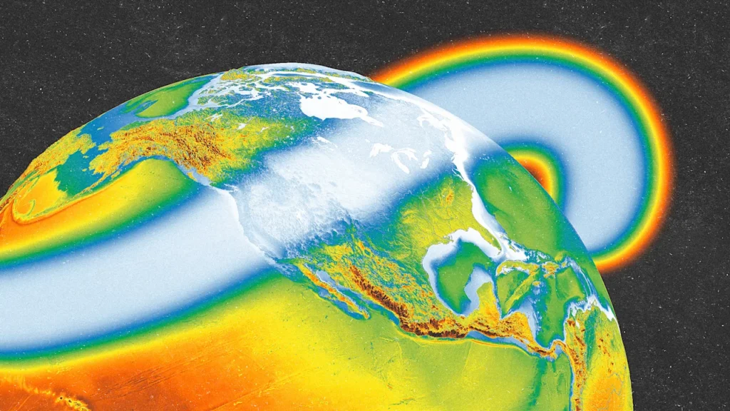
La Niña, a climate pattern that can affect weather worldwide, has officially arrived.
La Niña is fueled by colder-than-normal Pacific ocean temperatures, which then affect the pattern of the Pacific jet steam. It’s the cooler counter to El Niño, which involves warmer-than-normal ocean waters. Both are part of a weather system called the El Niño-Southern Oscillation (ENSO).
La Niña conditions emerged in September, the National Weather Service’s Climate Prediction Center said on Thursday. They’re expected to continue through the end of the year, and potentially until February 2026.
This La Niña is expected to remain weak, weather experts said, but it could still affect the winter, and even the hurricane season.
What does La Niña mean for winter weather?
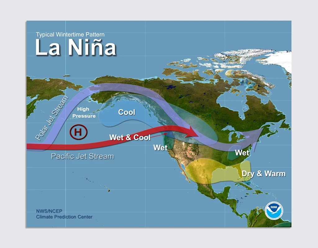
During La Niña, cold waters push the Pacific jet stream northward, which creates a “ripple effect” on the atmosphere. That jet stream then dips back down, dividing the U.S.
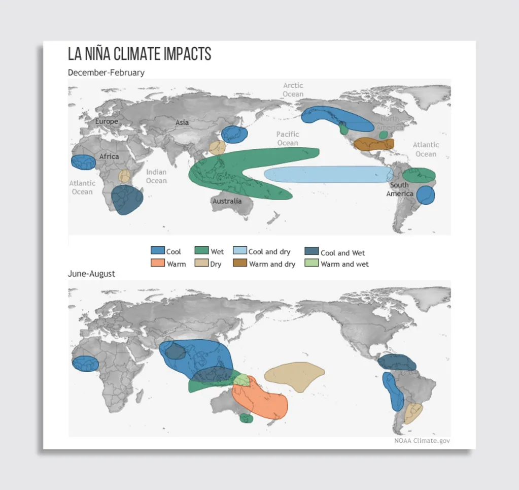
That then brings dry, warmer-than-usual conditions to southern states. Northern states see colder-than-normal temperatures and wetter conditions, particularly in the Pacific Northwest.
La Niña winters tend to bring a lot of snow to the Pacific Northwest, and even across the Great Lakes and into New England. Southern states, by contrast, tend to see below-average snowfalls.
La Niña can also mean a more severe Atlantic hurricane season. So far this year, five tropical storms and four hurricanes have formed over the Atlantic, a bit below expectations. (On average, a hurricane season sees 18 topical storms.)
But La Niña could bring more. “La Niña conditions are associated with more activity (double the amount) in November when compared to ENSO Neutral and especially when compared to Novembers with El Niño conditions,” Matthew Rosencrans, lead hurricane seasonal forecaster with the National Oceanic and Atmospheric Administration (NOAA), told USA Today.
La Niña events can last one to three years, and a La Niña did span 2020 to 2023. The 2020 hurricane season saw the most tropical storms in the Atlantic ocean in any year on record, with 30 total.
A weak La Niña, and what’s next
This La Niña is expected to be weak, experts say, but it could still alter our weather. A weak La Niña can also make it more difficult to predict that weather.
“A weak La Niña would be less likely to result in conventional winter impacts, though predictable signals could still influence the forecast guidance,” per the Climate Prediction Center.
2024 saw a weak La Niña winter, but it still gave us “typical” La Niña impacts. “Most of the southern U.S. and northern Mexico were predicted to be and turned out to be drier than average, with record-dry conditions in southern Arizona and parts of New Mexico, NOAA meteorologist Nat Johnson wrote last spring. “Wetter conditions were forecasted and did prevail over the northern part of the continent, particularly in Alaska and parts of the Pacific Northwest.”
In some instances, though, the reality differed from forecasts, like when a “ribbon of wetter-than-expected” weather hit Texas, Arkansas, Kentucky, and western Virginia. “Despite these regional differences from expectations,” Johnson wrote, “the big picture was pretty La Niña-ish overall.”
La Niña and El Niño aren’t always active. These events typically happen every two to seven years, on average. The ENSO cycle is a break in normal wind and water patterns, and weather experts say we’ll likely see a transition to “ENSO-neutral” conditions this spring.